
Surveys taken: Monday 1 August
This survey gives snapshots of travel times in traffic conditions at two different times as given by Google’s crowdsourcing techniques*. Drop offs at disabled-friendly rear entrance to UCLH. Gower Street drop offs are about 3 mins quicker. A starting point anywhere on Judd/Hunter would give similar results.
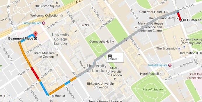
1. Old route via Tavistock Place westbound
No longer possible so no accurate time in traffic can be given.
Distance 0.9 miles, travel time not available, estimated 10 mins,
(Link to live map)
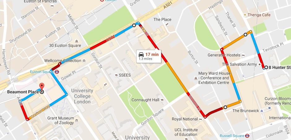
2. Via Coram Street and Woburn Place
Feasible under all current and proposed restrictions.
Distance 1.3 miles, times: 17 mins at 10:15 am, 15 mins at 3:45 pm, (Link to live map)
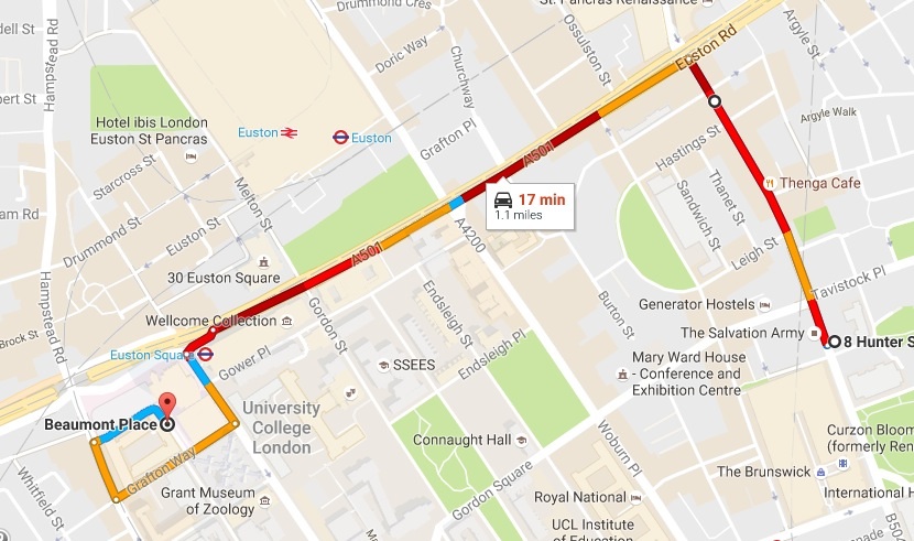
3. via Judd Street and Euston Road
Currently feasible but will not be with banned left turn at Judd St/Euston Rd.
Distance 1.1 miles, time 17 mins at 10:15 am, 11 mins at 3:45 pm, Link to live map
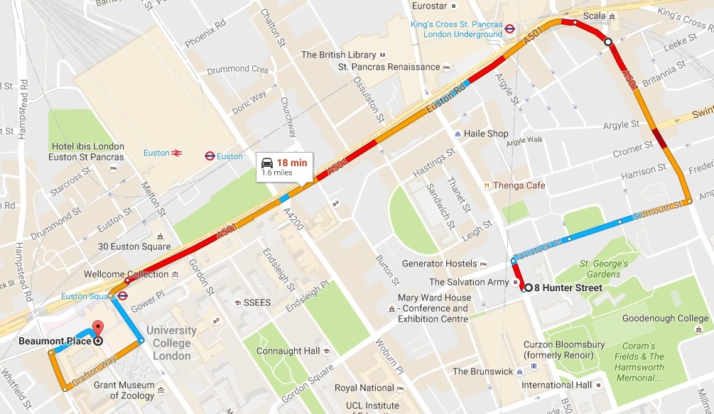
4. via Sidmouth Street, Gray’s Inn Rd and Euston Road
Feasible under all current and proposed restrictions.
Distance 1.6 miles, time 18 mins at 10:15 am, 13 mins at 3:45 pm, (Link to live map)
* Google’s crowd-sourced traffic data is compiled by tracking mobile phones in vehicles. It is widely used and anecdotally, it seems to be respected by drivers who have checked its accuracy (https://goo.gl/ErTXuc).