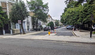
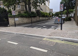
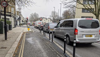
Work started last November on the westbound lane and continued throughout the pandemic and then this summer work started on an eastbound pop-up cycle lane. The work is now complete apart from a planned bus stop bypass outside Talacre Gardens. The eastern end of this new 850m link connects through Castlehaven Road to the northern end of the C6 route on Royal College Street route that leads all the way to Elephant and Castle as well as linking to Tavistock Place and to the C3 Embankment route. The western end will link directly to the proposed pop-up cycle lanes up Haverstock Hill. At the mid-point Crogsland Road provides a link to Primrose Hill and Chalk Farm.
The westbound cycle lane
This was designed as a high-quality 2m wide cycle lane. Between the junctions, most of it is behind parked cars which have been moved out away from the kerb. There is a short section of stepped track at the Haverstock Hill end and kerb protection on both sides of the Malden Road junction.
Linus Rees has made this video of a ride along PoW Road westbound on the morning of Saturday 28th November. If you haven’t yet used this route, the video will give you some idea as to what awaits you.
Bus stop bypasses
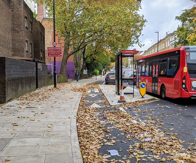
There are four of these along the westbound track. At each one, the bus passengers wait on an island before getting on the bus – if there’s a shelter it is placed on the island. The cycle lane runs between the footway and the island. Zebra markings are painted across the cycle lane to give cyclists the idea that they should wait for pedestrians to cross. In addition, the cycle lane is raised to footway level as it passes the island, to provide a level surface for pedestrians and to reduce the cycling speeds.
 |
 |
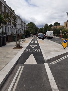 |
Continuous footway across all side road junctions
The footway is constructed so that it looks as though pedestrians are supposed to walk across without hesitation. Drivers of motor vehicles should treat this area as part of the footway that they have to cross to go into and out of the side road. In addition, the footway across the side road will be at the same level as the footway on either side to slow the drivers down. In practice, the footway across the side roads is built of stronger material than the pavements on either side but the colour is continuous.
Note that Hadley Street is on the westbound lane and the crossing has been marked correctly with logos and dasheds lines.
Cycle lane behind parked cars
The cycle lane is 2m wide which allows people to keep away from the car doors to avoid being “doored”. Before construction, we had wondered whether a 0.5m shaded area should be painted as a buffer to encourage people to keep away from the doors but we haven’t asked Camden to do this. We had also wondered whether armadillos should be used to enforce parking outside the cycle lane but drivers seem to be parking considerately outside the white lines.
Parked cars close to junctions obscure the view
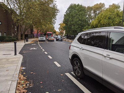
The photo on the right shows the approach to the junction of Harmood Street. Anyone driving in the same direction as the cycle lane will not be able to see cyclists until the last moment before turning into Harmood Street. The legally parked car in the photo is only about 5m from the junction – while Camden has a new policy that there should be no parking or loading within 10 m of a junction.
For cyclists’ safety this applies mainly to the approach side but for pedestrians’ safety this applies on both sides of the side road.
Camden has agreed to cut back the parking bay and to mark double yellow lines. They also propose emphasising the cycle lane with blue paint as it crosses this junction as well as at the Crogsland Road junction.
Entry to and exit from the cycle lane from junctions opposite
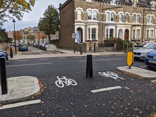
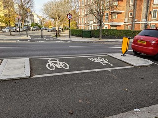
There are three side roads on the north side of Prince of Wales Road and in all of these cases, the right turn out of the side road and into the westbound cycle lane is an important manoeuvre. Space is provided for people on bikes to pause on the way in or out of the cycle lane (by the marked logos in the photos below). This waiting space is protected from the parked cars by a paved area at each end. In each case, some parking spaces had to be sacrificed.
 |
 |
 |
Malden Road junction
The improvements at this junction are very much welcomed. The main benefit for people who cycle is the ‘tightening’ of the junction so that the distances between entrances and exits are much shorter. Pedestrians also have benefited from the shorter crossings and a diagonal crossing.
Early release for cycles with low-level lights is provided on all four arms and two-stage right turns are provided on Prince of Wales Road.
 |
 |
The photo on the left shows the approach to the Malden Road junction where motor vehicles are banned from turning left into Malden Crescent. Anyone on a bike who wants to make that turn can use the little cut-through.
Drivers turning right into Malden Road are provided with a separate lane while people on bikes can do a two-stage right turn by going to wait on top of the marked logo in front of the ASL box at the top of Malden Crescent. But most people seem to prefer to turn right with the motor vehicles. Is this because they are unaware of the idea of a ‘two-stage right turn’?
The cycle lane here is far too narrow – due to rather over-enthusiastic widening of the footways and narrowing of the available road width. The lane needs to be widened and it should be protected with wands/bollards all the way to the ASL box.
The route across this junction is very clear, being marked with cycle logos and then with dashed lines and logos between the diagonal and straight pedestrian crossings. The section immediately after the junction is protected by kerbs.
The eastbound pop-up cycle lane
This has been built rapidly and is funded by the government’s post-Covid active travel initiative. It was conceived as a mandatory 2m cycle lane protected by flexible bollards and it involved removing all of the car parking bays on the north side of Prince of Wales Road.
This Video taken by Linus Rees on 27th November 2020 shows you what it’s like to use the eastbound cycle lane. It is generally of very good quality. But on setting off from Haverstock Hill, on both sides of the Malden Road junction and through the railway bridge, the lane is either non-existent or too narrow.
Riding along the eastbound cycle track
 |
 |
 |
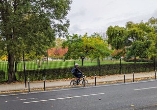
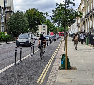
The above photos show that there is a high-quality cycle track most of the way along Prince of Wales Road. It has been a great achievement by Camden to get this in place very quickly.
What needs to be fixed?
The video shows that after turning the corner from Haverstock Hill, the cycle lane doesn’t start for about 30m. The other three serious issues are shown in the three photos below
All of the above four issues are fixable and we have asked Camden Council to work on them to bring this scheme up to an excellent standard.
Shared use bus boarders (SUBBs)
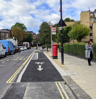
The photo on the right shows a SUBB. The bus boarder is in line with the cycle lane and the bus stops beside it. The markings have been standardised in that you will see the same in other pop up schemes including York Way. But the arrangement is the same as that for some of the bus stops on the Royal College Street northbound cycle lane. SUBBs have to be used when the road isn’t wide enough for a bus stop bypass.
There are three bus stops on the eastbound track. The next SUBB is placed opposite Crogsland Road and causes great difficulties to people turning right out of Crogsland Road. This is a popular movement and we have heard many complaints.
The third bus stop is outside Talacre Gardens and currently it interrupts the cycle lane but we understand that a bus-stop bypass is to be constructed.
Camden have a good write-up on SUBBs which we have uploaded here.
A nice touch
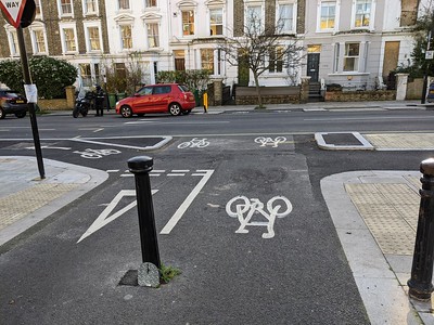 Considering that this was a Pop-Up scheme, we were impressed by the effort that went into incorporating the eastbound track into the existing Queen’s Crescent cycle link to Prince of Wales Road. The design of this cycle track intersection reminds us of some we have seen in The Netherlands.

