This map is based on a dataset that records all the traffic filters by means of bollards, gates, or signs throughout Camden. This includes historic data (which may be incomplete).
Note: the Healthy School Streets are now shown on a separate map. See here.
Larger Map – the Google Sheet on which it is based here. And for people who can’t access Google Docs, a PDF (5th Dec 203)is here.
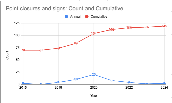
Year by year progress
Roll the cursor over the points to see the counts.

Image of the interactive chart for people who can’t access Google Docs


