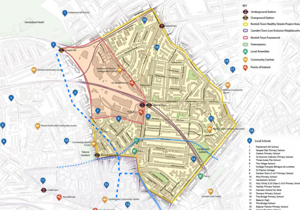
Camden Council wants to improve the Kentish Town area, including improving air quality and making walking and cycling easier and safer. The area included is shown here
Camden has already been engaging with stakeholders at meetings and with local people via the Commonplace engagement map at:
https://kentishtownhealthystreets.commonplace.is/
That map has (on 1st March) almost 250 comments about the conditions on the roads in the area, many of them very useful.
But for our response, I would like to aim for something at a higher level
e.g.
A: what could be done to improve Kentish Town Road for cycling?
B: do you have suggestions for improving the cycle network in this area?
See blue lines on this map
Royal College Street: the solid blue line;
Castlehaven Road – Grafton Road: large dashes;
Prince of Wales Road (westbound route under construction): small dashes
The main roads in the area (Kentish Town Road, Fortess Road, Camden Road and St Pancras Way- Royal College Street) are supposed to carry most of the traffic, while Brecknock Road, Torriano Avenue, Leighton Road and Highgate Road are emergency routes.
The other roads are called ‘access roads’.
C: Which of the access roads needs a substantial reduction in motor traffic e.g. by eliminating through traffic?
D: Do you have ideas as to where it would help to have a cycle crossing across one of the main roads e.g. From Islip Street to Holmes Road across Kentish Town Road?
CCC’s response
To be written


