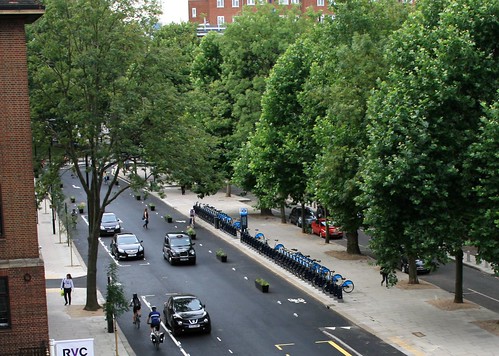
The new wide, one-way lightly-segregated tracks are now open for use.
Regular users of the Royal College Street cycle tracks have now been rewarded by the opening of this excellent new scheme after a few months of inconvenience while it was built. The duration of the construction period was lengthened due to unrelated problems with water works.
There is now a pair of 2-m wide, one-way lightly-segregated tracks, one on each side of the road. They run between Baynes Street and Crowndale Road. The extension to Baynes Street provides a useful link to the ramp exit from Regents Canal. Cyclists are segregated from motor vehicles by means of armadillos and planters. This light segregation makes it easy for cyclists to pop in and out of the track and for pedestrians to cross the road. It also uses up less of the available road width than the 0.7m kerbs of the previous scheme, thus allowing a pair of 2-metre tracks rather than a pair of 1.5 m tracks. It is apparently much cheaper which should enable more of these schemes to be built.
Armadillos
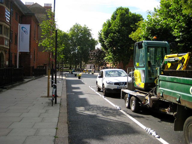
Where the tracks are inside parked cars, they are protected by ‘armadillos’ – round rubber blocks screwed down to the road. The armadillos were manufactured for this project from recycled rubber, similar to some used in Barcelona but with white instead of yellow stripes. Camden Council has tested their durability by driving a heavy vehicle into one which appeared to be unaffected.
Planters
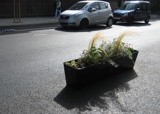
Where the motor carriageway is adjacent to the cycle track, they are separated by planters. There are a couple of armadillos between each pair of planters. The planters were made locally by the Front Yard company in Kentish Town who also supplied the plants and planted them. The planters are like the PlantLocks, but without the attachments for parking bikes.
Southbound
Southbound cyclists now ride in a two-metre wide track on the eastern side of the road. For most of the way, this track runs inside the parked cars and armadillos are in use. Where there are no parked cars, planters protect the track, as shown in the photos below.
Armadillos, parking and planters and close up of planter (on the southbound side of the road)
  |
Northbound
Northbound cyclists ride in a 2m wide track on the west side of the road between Crowndale Road and Baynes Street. Planters are used all the way along this side of the road, where there is no parking. During the construction phase we had already noticed that the raised bus stands on the cycle track have very acceptable gradients. The motor carriageway is about 4 m wide and the intention is that when the bus stops, other vehicles will wait behind it, although they can get past when there is no adjacent car parked on the other side. See the photos below.
Planters, armadillos and view of the stopped bus with the traffic queue behind 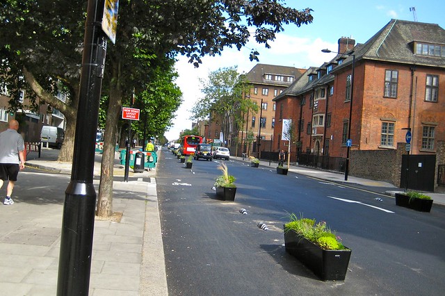
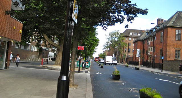
Crowndale Road junction
The crossing over Crowndale Road has been redesigned and a new signal head installed to accommodate the southbound cyclists now on the east side of the road. This involved cutting a new track through the island as well as the signal changes. It seems to work very well. It also provides an opportunity for cyclists to turn left which they couldn’t do before. Photos of green signal for southbound cyclists and view of the junction from the south side of Crowndale Road
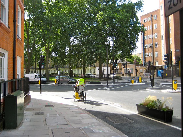
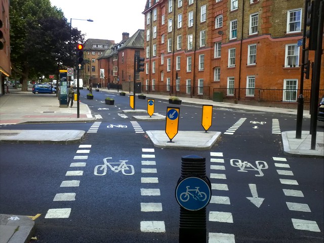
Car Parking
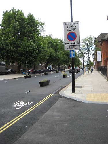
The council has decided that there should be no yellow lines. Instead they have designated a “Restricted Zone” which means that vehicles can be parked only in the parking and loading bays as shown in the photo on the right. If this works, it is a good, simple scheme, but we are a little concerned that someone not knowing the rules will park in the southbound cycle lane (which is a contraflow). But we wait to see whether the rules will be enforced.
See Christian Wolmer’s blog on ‘Time to consign Yellow lines to History‘.
Junction tables, signals
New tables have been constructed across Plender Street, Pratt Street and Georgiana Street. These, together with the narrowing of the vehicle carriageway to 4m, seem to provide traffic calming. During the construction phase we had noted that the single carriageway had a calming effect. The signals were removed at the junction with Georgiana Street a few weeks ago and this appears to have simplified the junction.
Outstanding Work
The above photos were taken on 11th to 13th August south of the junction with Plender Street.
Further north, things are a little untidy, for example, cones have been placed where armadillos are missing. But all the planters are in place and have been planted. Since 13th August the southbound track between Baynes Street and Georgiana Street is open. The temporary cycle track around the national Grid Site on the corner of Pratt Street will be in place for some time to come.
Phase 2 across Camden Road to St Pancras Way
The main task is the crossing of Camden Road: we understand that the junction is currently being modelled to provide southbound cycling and a bus contraflow to Randolph Street. We have been told that preliminary designs should be available by the end of 2012.
Acknowledgements
This is a very exciting scheme. It fulfils everything promised in the consultation and is surely the first real attempt to “Go Dutch”* in London. We hope to see many more in the near future. In spite of the delays during construction, it has been carried from design through consultation to completion in only a little more than a year. Congratulations to Camden Council for having the vision to move from the 2000 AD scheme, which was in its time a flagship one, to the current exciting scheme†. A special mention is due to Brian Deegan for the vision and to Simi Shah and John Futcher for pushing the scheme forward to completion. Finally Diljeet Singh, the on-site manager, has paid exceptional attention to detail, working at all hours, almost living on site.
Jean Dollimore, 12th, 13th August 2013
Footnotes 17 August 2013
† Originally this referred to the “current truly Dutch scheme”. But following feedback, I realised that it would be more appropriate to say that it’s a truly eclectic scheme in the sense of taking the best on offer from a variety of sources. The lane widths conform to Dutch CROW standards, the armadillos are from Barcelona, the idea of using planters came from Vancouver and I understand that the bus stops are like some in Copenhagen. More about the bus stops is to follow. * The term “Go Dutch” here and in the title refer to LCC’s campaign to “make our streets more liveable for everyone by making them as safe and inviting for cycling as they are in Holland”. The aerial photo on the left was taken from the top floor of the Vet College and supplied to us by Camden Council.
Bus stops (draft to be worked on and further illustrated)
There are two bus stops, one between College Place and Plender Street and the other south of Pratt Street. In both cases, the bus stops outside the cycle track so the passengers get on and off the bus onto the track.
There is a maximum of 6 buses an hour, so regular users don’t often find they have to wait for the passengers. See the timetable. The arrangement has been used without problems since 2000, the only objection by cyclists was the very severe ramp in the original scheme– the new ramp is gentler.
However, we have observed that some cyclists prefer to change the vehicle lane or to overtake the bus. This move wasn’t possible with the kerb segregation of the original scheme.
See photos of Den Haag, Copenhagen and Royal College Street
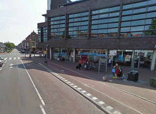
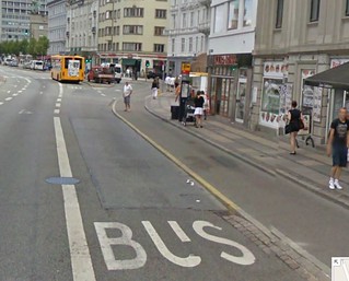
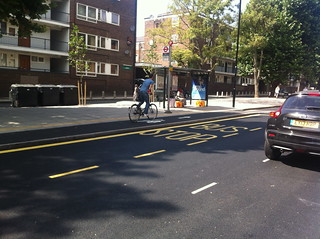
Island bus stops?
Note that there is a little extra space available by the above two bus stops (e.g. about 1 m at southern one, but the space may be better deployed in making a buffer between parked cars and the SB cycle lane). Note: Phase 2 of the scheme will need to incorporate existing bus stops opposite Randolph Road and by Ivor Street (north of Camden Road). Note also that with an island pedestrians have to give way to cross the cycle track but this is quicker than getting on and off buses.

