 Karl Brierley who is is Camden’s Principal Transport Planner for Low Emission Neighbourhoods and Healthy Streets made reference to Camden’s Transport Strategy noting that:
- for improving road safety, Kentish Town Road has the third-highest priority while two junctions (Chalk Farm Road at Ferdinand Street and Torriano Avenue at Camden Road) also have high priority;
- Camden’s planned borough-wide cycle network is a key priority for the project.
And he mentioned two upcoming healthy school streets schemes in the area:
- Haverstock;
- Holy Trinity & St Silas C of E Primary School in Clarence Way which will come forward to for consultation in the coming weeks.
also
- the Bonny Street – Camden Gardens crossing will come forward for consultation as it is nearing finalised design ;
- the Kentish Town Road – Angler’s Lane scheme for which TfL has asked Camden to carry out another traffic count.
Pedestrianisation of Camden High Street – between the station and Hawley Crescent
We enquired whether the trialling of a weekend pedestrianisation scheme on Camden High Street was really pedestrianisation in the sense of excluding all vehicles including bicycles. And were rather shocked to hear that it does intend to exclude bicycles.
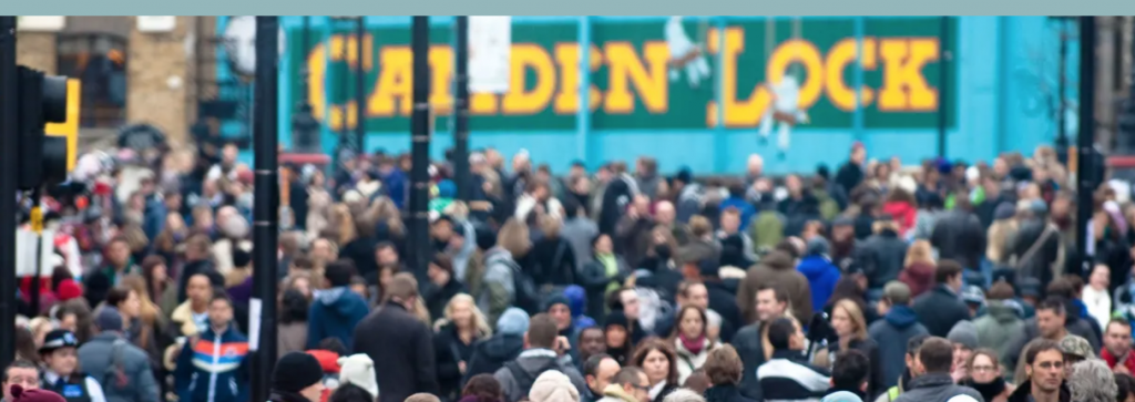
Karl tried to justify this by showing the image of the crowds filling the entire space from building line to building line during car free day in 2010. Karl stressed it was a trial and can be tweaked.
The two schemes include these aspects:
Behaviour change e.g. ‘Healthy School Streets’ and ‘Play Streets’.
Enabling Smarter Travel by Camden Cargo Bike Network providing a service to companies, identifying their free freight needs offering loan bikes. Working with UCL at present but looking for business in both project areas to work with.
Improving and upgrading the walking and cycling connections in the Camden Town area – we hope this will include reducing motor vehicle traffic on the cycle links such as Arlington Road.
Improving conditions for walking and cycling to and along Kentish Town Road as well as improving the proposed network of Primary and Secondary cycle routes in the vicinity of Kentish Town Road.
Bikehangars throughout the area.
Sustainability installing EVCPs.
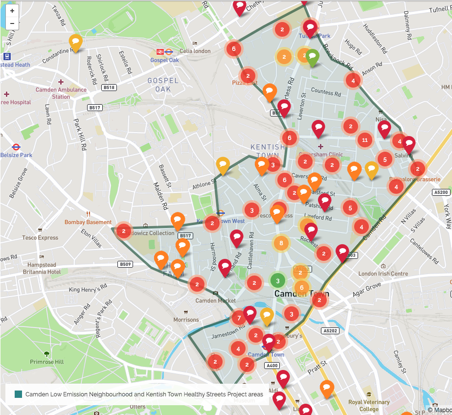
The approach to area-based engagement, with a commonplace map, is a new approach for Camden.
Corridor schemes such as the Gray’s Inn Road scheme will continue to be designed first and then presented for consultation as before.
Letters were sent out to 9000 households in the Kentish Town area and 3000 in the Camden Town area inviting people to visit the engagement map.
People have been into the Kentish Town and Camden Town Commonplace engagement and have:
- placed their pins to locate their concerns using appropriate tags from the wide set offered as well as writing comments;
- looked at pins placed by other people and where appropriate expressed their agreement.
Red pins express serious worries, orange pins are still worries while green ones are delights such as the Home Zone outside Eleanor Palmer School.
Businesses will be consulted in a separate survey about their loading patterns.
Stakeholder management group meeting
These were held, one for each scheme, a few weeks before the CommonPlace engagement.
Drop Ins and Pop Ups
There have been several and another is to come on Tuesday 25th at Torriano School; these can all be found on the commonplace site.
Consultation Board – to be at the Busby Place entrance to Cantelowes Park and then at James Wigg.
 Co-Design in April
These will be Drop Ins and will involve the stakeholders and the data from the surveys will be available.
Traffic counts and other data will be available.
Origin-Destination surveys
We were very impressed when Karl showed us a slide about the Origin-Destination surveys with entry-exit points on Kentish Town Road, Camden Road and Brecknock Road. A journey was considered as local if it entered the area without leaving within 15 minutes.
e.g. Torriano Avenue has very little local traffic, while a route via Busby Crescent contains a very high proportion of journeys to Kentish Town Road.
Another map shows the proportions of vehicle types and indicates that the filters on Sandall road and Bartholomew Road do mainly keep out HGVs.
Parking Density data
This shows the ratio of permits to parking spaces on a map. e.g. Patshull Road is 40% and could afford to have parking spaces removed.
All of these results will be published online.
After a long presentation interlaced with many questions, George, who was chairing the meeting thanked Karl for an excellent talk and we all seconded that by an enthusiastic round of applause,
Here is a PDF version of Karl’s slides
Camden Cyclists LEN and HSP 17_02_20 small
Camden Cyclists LEN and HSP 17_02_20


