
This set of new cycle permeability measures illustrates how what seem like small improvements can add so much convenience to a journey by bike. They include two new stretches of contraflow cycling, two new exceptions to ‘No Entry’ and a pair of dropped kerbs.
They were consulted on last October and have all been implemented during the lockdown. You can see details of all the permeability improvements since 2010 here along with further ones we have asked for.
Grove Terrace and Grove End
Grove End and Grove Terrace run parallel to Highgate Road from Chetwynd Road. New dropped kerbs have been installed at each end of a pair of existing road closures shown on the map below.
These changes will make it possible to cycle from Chetwynd Road parallel to Highgate Road along Grove End and Grove Terrace across Dartmouth Park Road without the need to hop up and down footways. There is also a new right-turn pocket for southbound cycles on Chetwynd Road to facilitate a turn into Grove End.
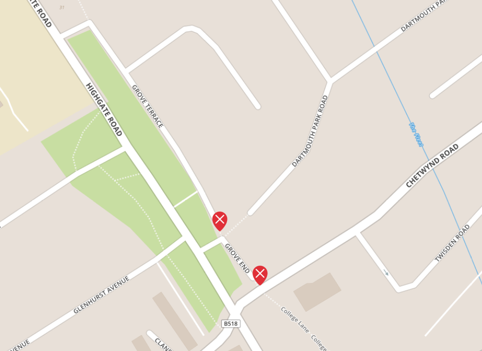
Photos 1 and 2 show views at the Chetwynd Road junction. Four metres of residents parking has been removed and a short section of the footway will be converted to a shared cycle and pedestrian space.
")
")

Photo 3 shows the new right-turn pocket for southbound cycles on Chetwynd Road to facilitate a turn into Grove End.
Photos 4 and 5 show the dropped kerbs on both sides of the entry to Grove Terrace and the new double yellow lines where parking spaces were removed.

")
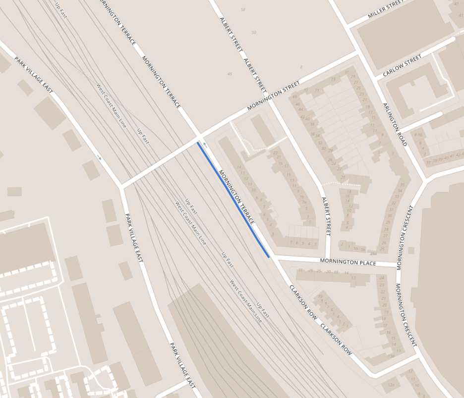
Mornington Terrace
The map below shows the location of the new section of contraflow cycling on Mornington Terrace between Mornington Place and Mornington Street. The remainder of Mornington Terrace is still one way northbound from Mornington Street to Delancey Street. Our request was for two-way cycling through the entire length of Mornington Terrace. But Camden has decided not to take forward the northern section at this stage as there are higher motor traffic flows and the street is narrower. However, there are considerable benefits in having the southern section two-way for cycling e.g. for making a connection between Park Village East and Mornington Crescent.


The photos 6, 7 and 8 were taken early one morning in March, soon after the scheme was built. Photo 8′ was taken more recently.
Laystall Street
The map below shows the location of the new section of contraflow cycling on the northern section of Laystall Street – between Rosebery Avenue and Mount Pleasant.
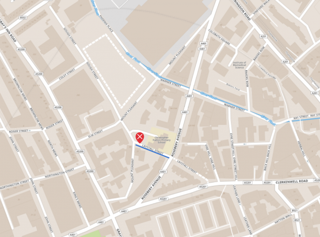
Before this recent change, the northern section of Laystall Street had been one way southbound. In order to introduce two-way cycling, Camden has restricted through-access for motor traffic using a dismountable bollard so emergency vehicles can still get through if required. Two-way motor traffic from Rosebery Avenue is still allowed for access to Christopher Hatton School and other local destinations.
This was our one outstanding permeability request in the Farringdon area and will complement the recently introduced two-way cycling in the southern section of Laystall Street. See our recent report on Farringdon: Improvements for cycling and walking.


 facing north")

On a recent visit we saw many people on bikes as well as a skateboarder using this new alignment between Clerkenwell Road and Mount Pleasant in both directions.
Gaisford Road and Patshull Road
The map below shows the five streets that intersect with Kentish Town Road south of Leighton Road. Each of them has a short stub of one-way adjacent to Kentish Town Road.
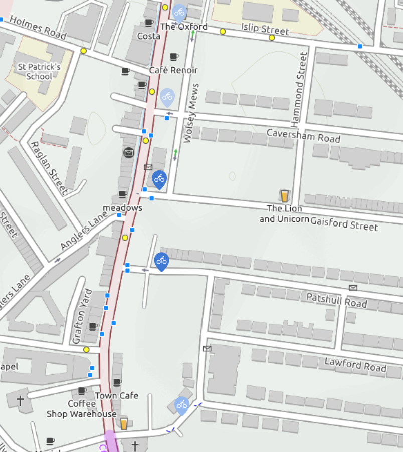
It has been a long battle to get two-way cycling through these stubs. The first was Islip Street, the second Bartholomew Road in 2004 with more recent improvements (replacement of gate with bollards) and then Caversham Road in 2018. Meanwhile, two-way cycling was introduced through Wolseley Mews (the neat cut through parallel to KTR) in 2014.
At long last, the last two (Gaisford Street and Patshull Road) allow cyclists to be exempted from the No Entry from Kentish Town Road.
The map which uses an Open Street Map cycle map rendering shows two-way cycling in Wolseley Mews and the bypasses at Islip Street and Bartholomew Road. But we are working on updating the map for Caversham Road Gaisford Street and Patshull Road.
Gaisford Street


Patshull Road


Progress with Permeability in Camden
The map below shows progress with a large number of permeability gains in Camden over a period of over ten years. Our suggestions are mainly those that can be implemented simply with a few signs, lines and logos. In most cases, the green pins indicate the gains while the ‘No Entry’ signs indicate some to hope for.