
News from the Streets August 2026
News from the Streets Dec 2025
News from the Streets Sept 2025
News from the Streets May 2025
News from the Streets Sept 2024
News from the Streets May 2024
| Clerkenwell Road centre | Clerkenwell Road east | Goodsway | Goodsway centre | Goodsway west | Adeline Place | Greening |
Click on any image to see an enlargement
Progress on major projects under construction
Clerkenwell Road scheme complete
We were very pleased when Camden made the decision to implement protected cycle lanes on Clerkenwell Road: it is the first step towards our long-term campaign for Clerkenwell Boulevard (a cycle route from Old Street to Tottenham Court Road). We are hopeful that it will continue westwards as part of the Holborn Liveable Neighbourhood scheme.
The Clerkenwell Road scheme was completed in August. It provides protected cycle lanes on both sides of the road for about 450m between Grays Inn Road (GIR) at the western end and Farringdon Road at the eastern end.
The cycle lanes are implemented as stepped tracks apart from the central section where they are protected mainly by bus stop bypass islands.
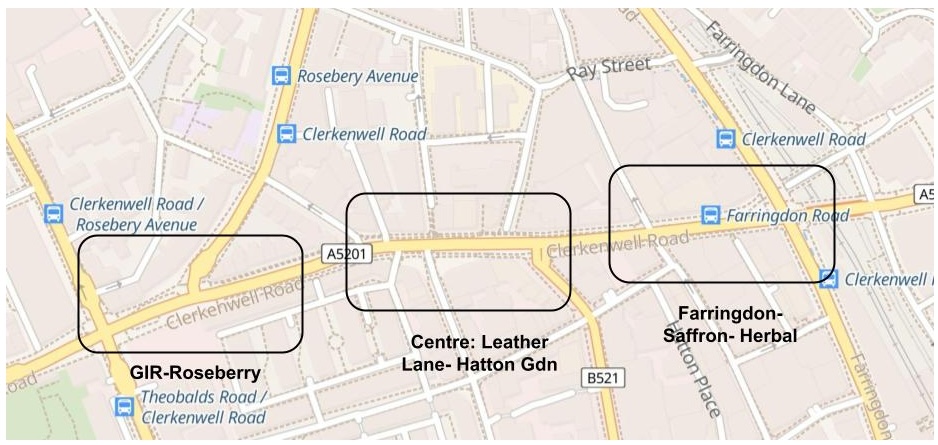
As construction work unrelated to this scheme prevents us from taking good photographs, we plan to leave a detailed description of the western section to a subsequent report.
Centre : Leather Lane to Hatton Garden
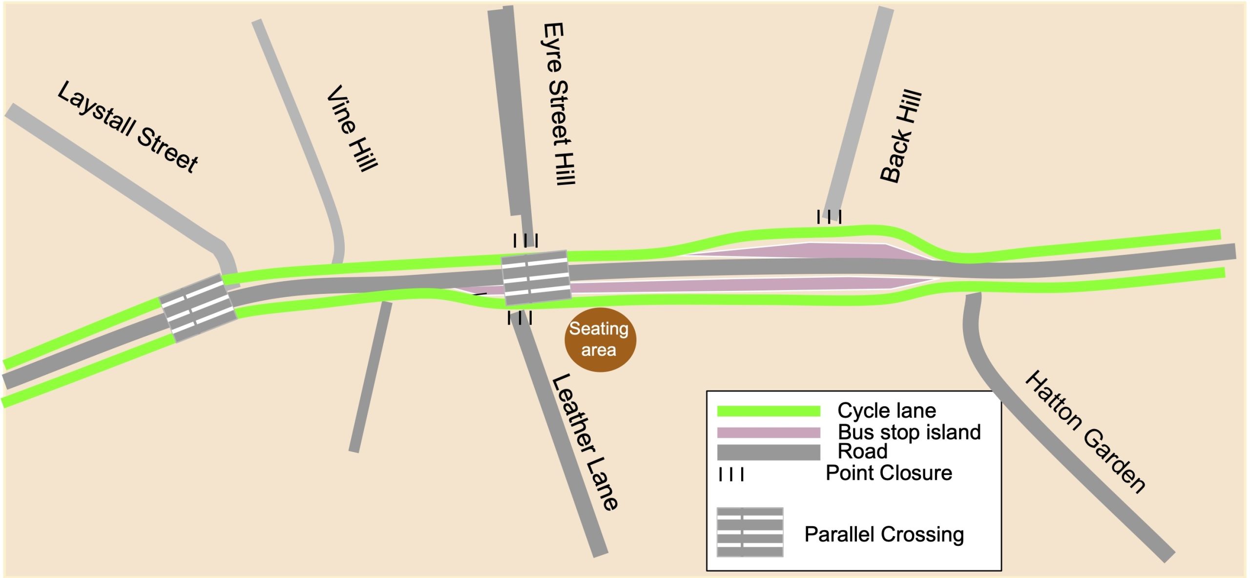
The implementation of point closures on three of the side roads has vastly simplified the design as there is no need to cater for motor vehicles crossing the cycle lanes at these junctions. Eyre Street Hill was closed in 2019 to facilitate two-way cycling; the historic closure on Back Hill has been moved from the northern end at Warner Street to the southern end at Clerkenwell Road as part of the current scheme; and Leather Lane was closed two years ago as part of a Safe and Healthy Streets scheme. These three side roads are fully accessible in both directions from the cycle lane that crosses them.
The Bus Stop bypasses
Westbound Bus Stop Bypass
This 2m wide bus stop island provides a place for bus passengers to wait with tactile tiles indicating the location of the mini zebra. The planting at the entry is currently protected by stakes but should look lovely by the spring. There is an e-bike hire bay at the far end. This arrangement makes a very clear separation between motor vehicles and other modes (walking and cycling).


Eastbound Bus Stop Bypass


The parallel crossings


The parallel crossing between Leather Lane and Eyre Street Hill is ideally positioned to provide a north south cycle route between these two closed roads. It also enables northbound access from Hatton Garden towards C6 on Warner Street and access to Leather Lane from the eastbound cycle track.
The parallel crossing west of Laystall Street provides access to Laystall Street and through to Roseberry Avenue from the westbound cycle lane.
The design of this central section gives this area the appearance of a ‘destination’ located at the seating area by the junction of Leather Lane.
We expect cycle routes to be punctuated by junctions but they become much more interesting if they also include destinations.

Eastern Section: Saffron Hill – Herbal Hill to Farringdon Road
Westbound route
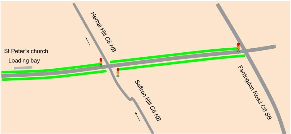
The very wide stepped cycle track provide a welcome to Clerkenwell Road; on the approach to the Saffron Hill junction riders are informed that they can turn right in two stages – no need to go out into the road.


The signals at Saffton Hill provide early release for cycles and a right turn pocket from which they can go into Herbal Hill to follow the C6 northbound route.


Eastbound route
Cycling east from the Back Hill bus stop bypass we see the inset loading bays

We then reach the junction with Herbal Hill.


The photo on the left shows the view through the junction: there is no protected cycle lane ahead. In the photo on the right, the grey car came from Saffron Hill and could have turned left or right but chose to join a queue and block the Clerkenwell Road cycle lane as well as the northbound C6 route. We have always argued that C6 should be on Farringdon Road from Greville Street to Ray Street to avoid using the narrow back streets on Saffron Hill and Herbal Hill. To prevent blockage of the Clerkenwell Road cycle lane we suggest ‘KEEP CLEAR’ markings across the junction.
From Herbal Hill to Farringdon Road


The eastbound lane has not been upgraded east of Herbal Hill. We would like to see a protected cycle lane and a bus stop bypass. The junction at Farringdon Road has remained unchanged since the completion of this section of the C6 route in 2019. Motor vehicles are not allowed to turn left on all approaches (so no risk of left hook). Two stage right turn pockets are provided with advance signs recommending their use. This junction needs an upgrade to allow cycles to cross the junction separately from motor vehicles and hence make right turns in a single stage. Can TfL be persuaded to modernise this junction and move C6 onto Farringdon Road? According to LCC it is the most dangerous junction in Islington. At that stage it would be wise to allow the left turns onto Farringdon Road.
Goodsway interim report
In the early 2000s, Goodsway was at the heart of three major developments – Kings Cross Central, adapting St Pancras Station for HS1 and the renewal of Kings Cross station. In 2012 Kings Boulevard became a pedestrian and cycling route over the new canal bridge to Granary Square eventually from 2017 using Camden’s first parallel crossing over Goodsway.
More recently there was new development on the south side of Goodsway from Pancras Square to the Google building. During this time it has remained an essential transport link and provision for walking and cycling has gradually improved.
In May 2020, new 2-m wide ‘Pop-Up’ cycle lanes were installed; they were protected by flexible bollards. Around that time, Goodsway was made one-way westbound for motor vehicles. In the new scheme, the cycle lanes are mainly protected by 60cm wide flat kerbs – at the western end the eastbound lane is behind an ‘island’. The new cycle lanes run on both sides of the road between the Google building and the junction with Camley Street. We understand that completion of the scheme including an upgrade at the junction with York Way is delayed until work on the Gas Station site is finished.
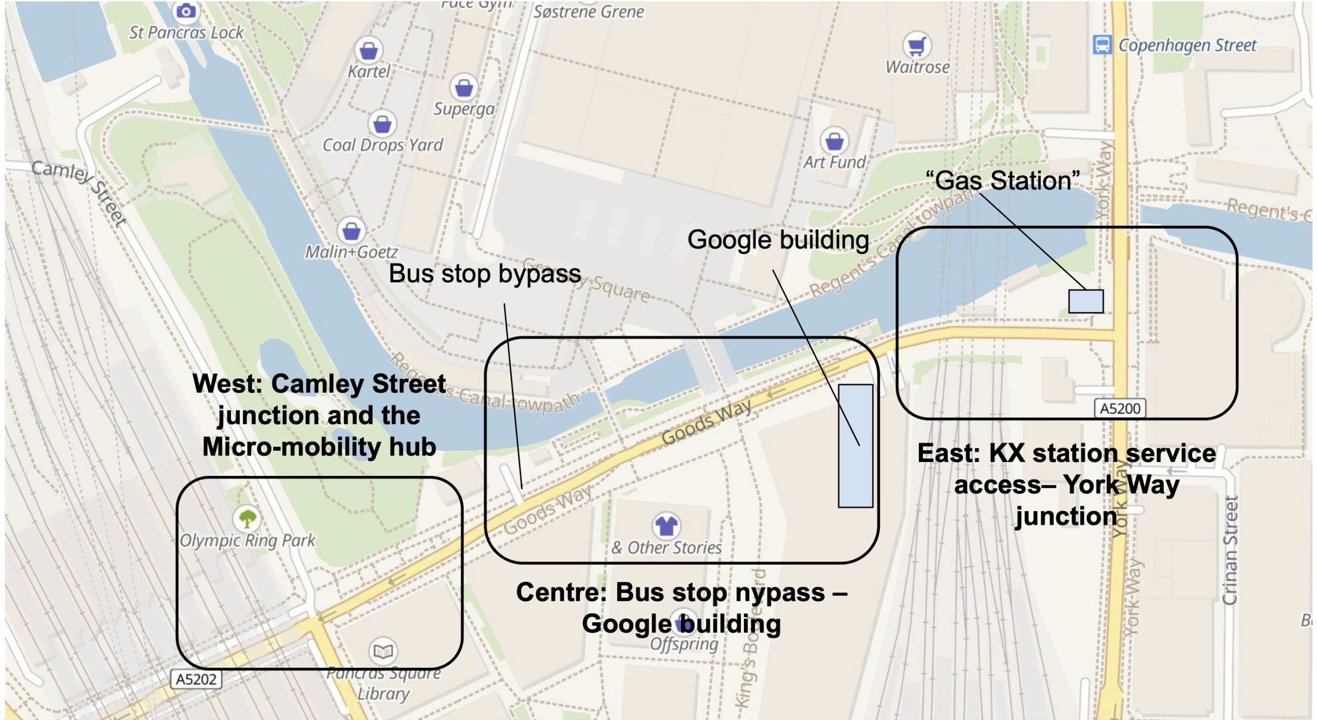
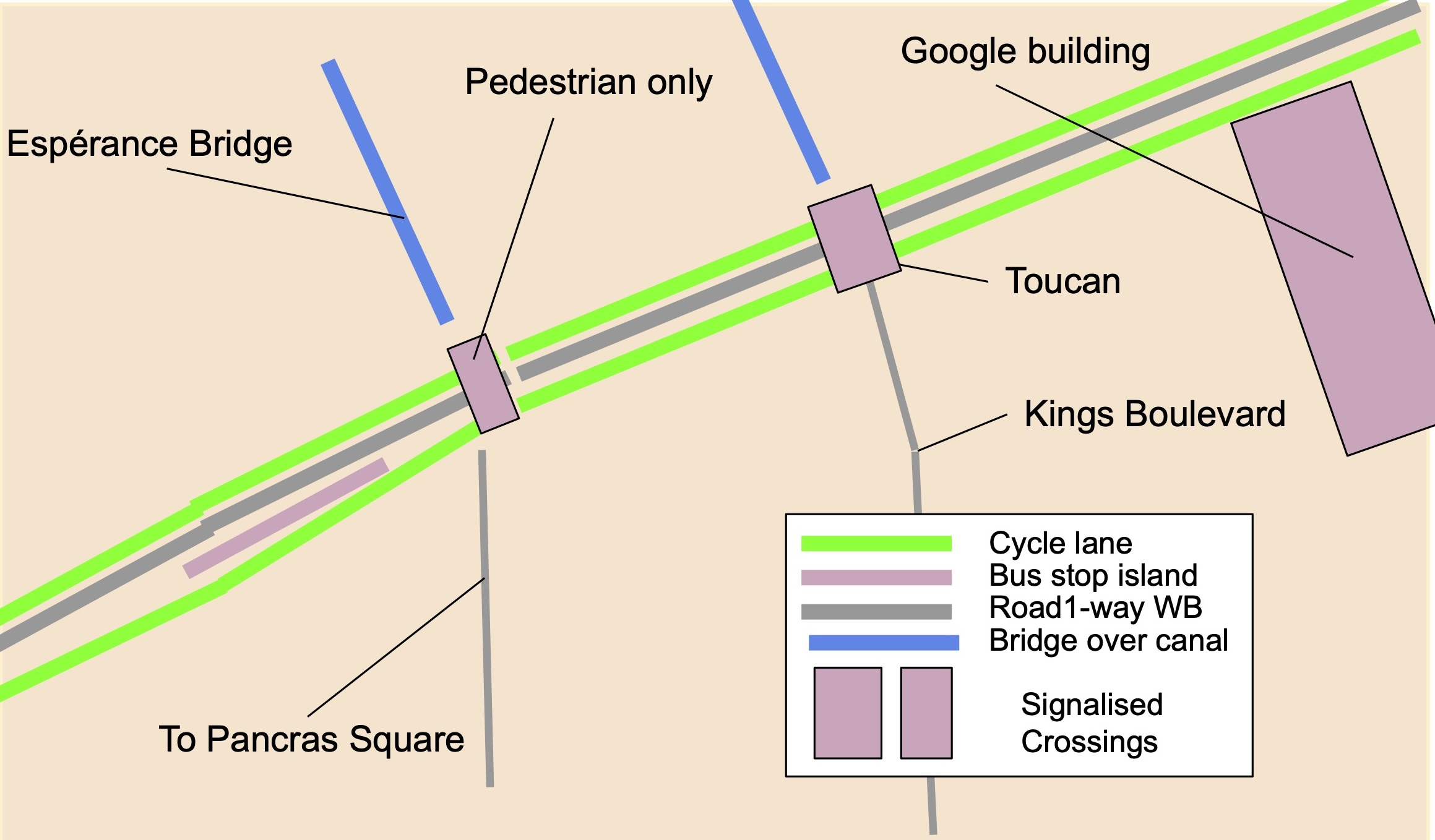
Goodsway centre section from the Google building to the bus stop bypass
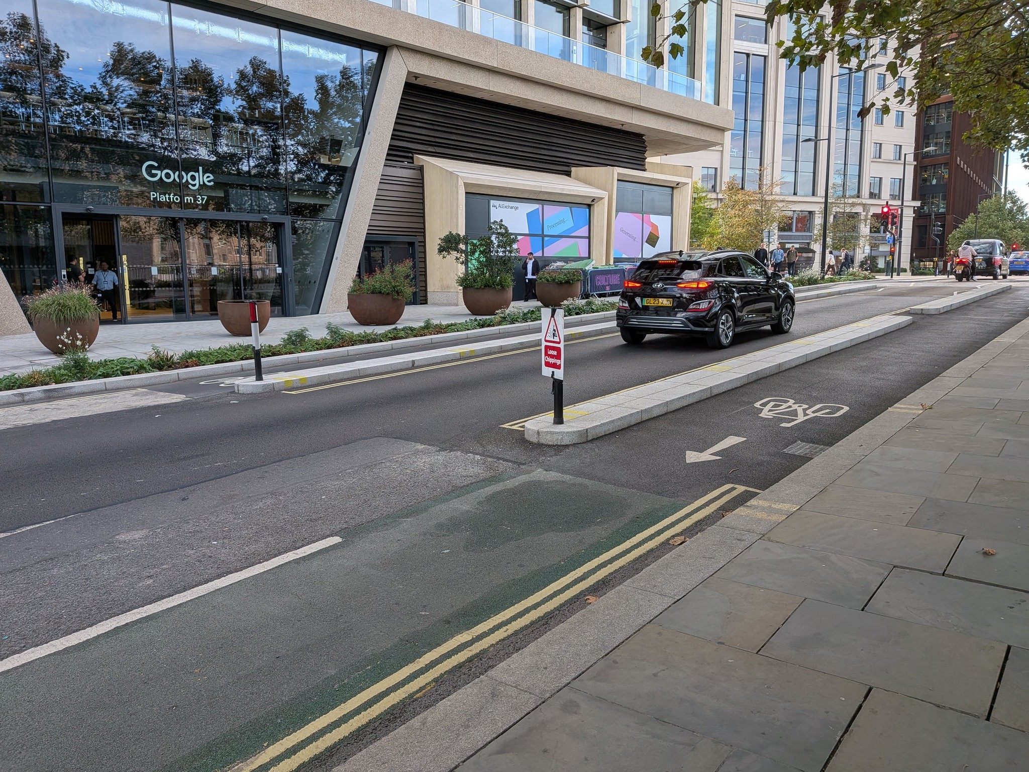
Starting from the Google Building
The space occupied by the former eastbound motor lane has been used to widen the southern footway and provide two substantial areas of greening.

The Toucan Crossing
The former parallel crossing between Kings Boulevard and Granary Square has now been converted to a Toucan crossing (with signals)


The signalised pedestrian crossing
The former zebra crossing between the Espérance Bridge and Pancras Square has now been replaced by a signalised pedestrian crossing.


Loading bay and bus stop bypass on the westbound side
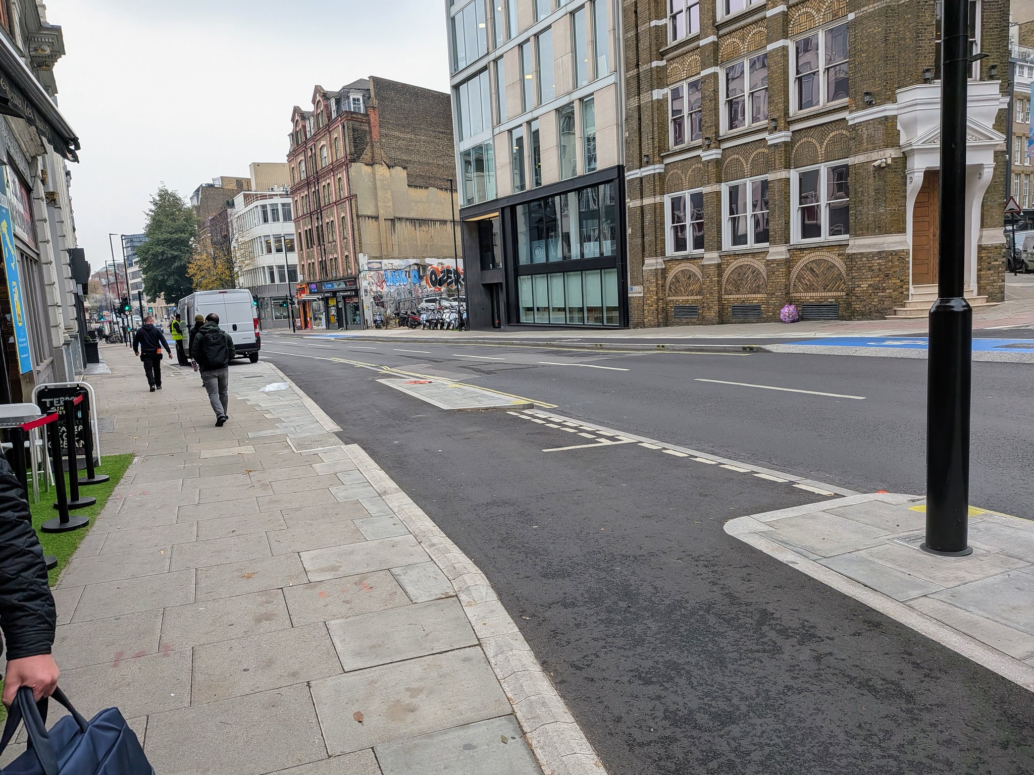
Soon after the pedestrian crossing on the downhill slope towards Camley Street, there is a loading bay followed immediately by a bus stop bypass.


Goodsway western section from the bus stop bypass to Camley Street
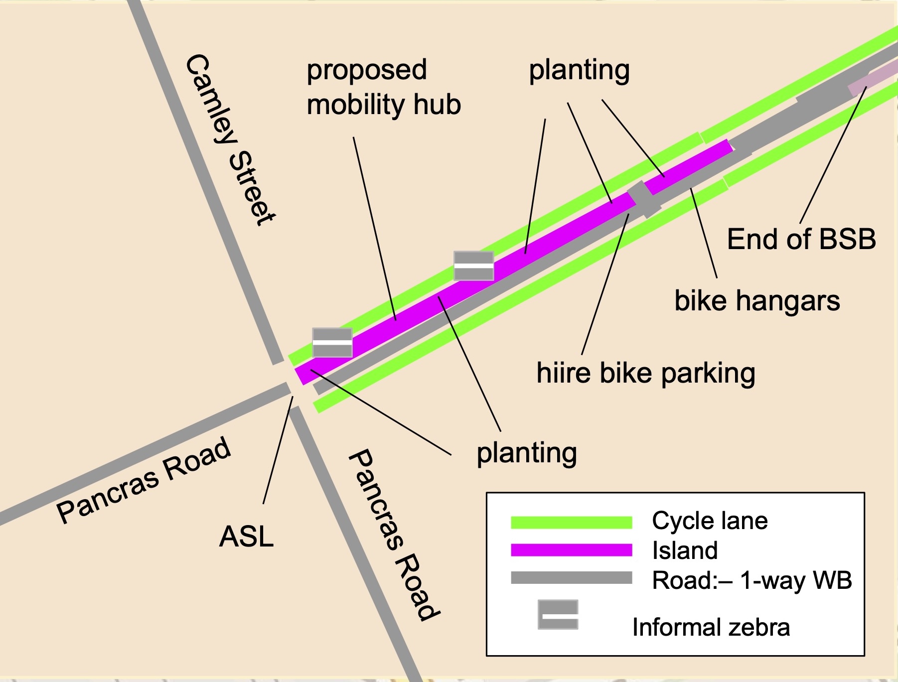
The space occupied by the former westbound motor lane is repurposed as an ‘island’ that will accommodate a mobility hub as well as a many cycle stands, a hire bike parking area and several areas of planting.
The photo on the right was taken early in September. It shows the eastbound cycle track and the island from the Camley Street end of Goodsway. It also shows the locations of the two informal zebras.
The nearer zebra (photo below) allows people to cross onto the island and wait for the pedestrian signal. It is very close to the junction and we wonder whether cycles turning left from Camley Street will be able to stop.
The second informal zebra (photo below right) is supposed to provide access to the island but the hire bikes are in the way,


The next two photos show the view of the island from further west


The footway on the east side is blocked by a crane so pedestrians are using the cycle track. We will report again when the mobility hub is in place and the planting has been done in the areas currently protected by chestnut palings – the second report will also evaluate safety of eastbound cyclists at the Pancras Road junction
Finishing touches and smaller projects.
Permeability through Adeline Place and Bedford Square west
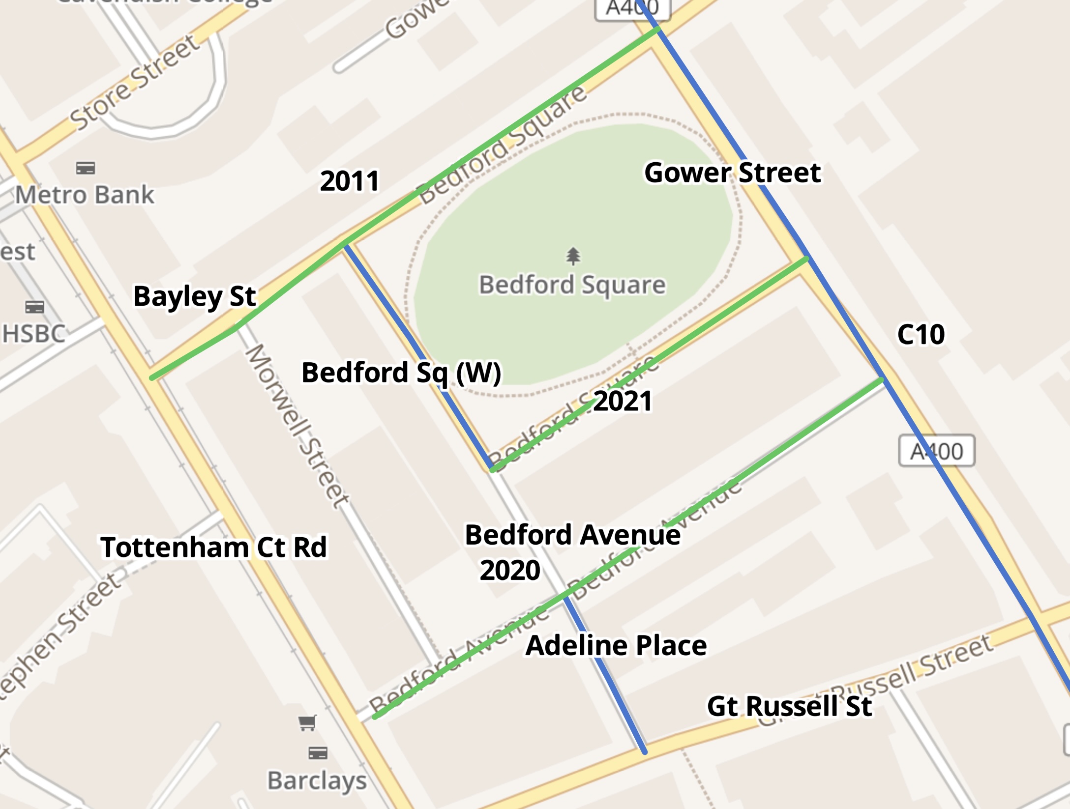
Camden has introduced two-way cycling on Adeline Place (south of Bedford Avenue) and Bedford Square (west side). They are shown in blue on the map while other roads where two-way cycling was introduced in the past are shown in green (with dates).
Adeline Place between Bedford Square and Bedford Avenue is two-way for all traffic.
The West End Project made Gower Street and Tottenham Court Road two-way in 2020.
The recent changes provide a complete permeability through this area, with a useful cycle route to the British Museum. Unfortunately Great Russell Street is still one way eastbound so the return route will not work.


It is good to see the continuous footway at the junction of Great Russell Street and the wide island with a cycle hire docking station protecting the contraflow cycle lane.

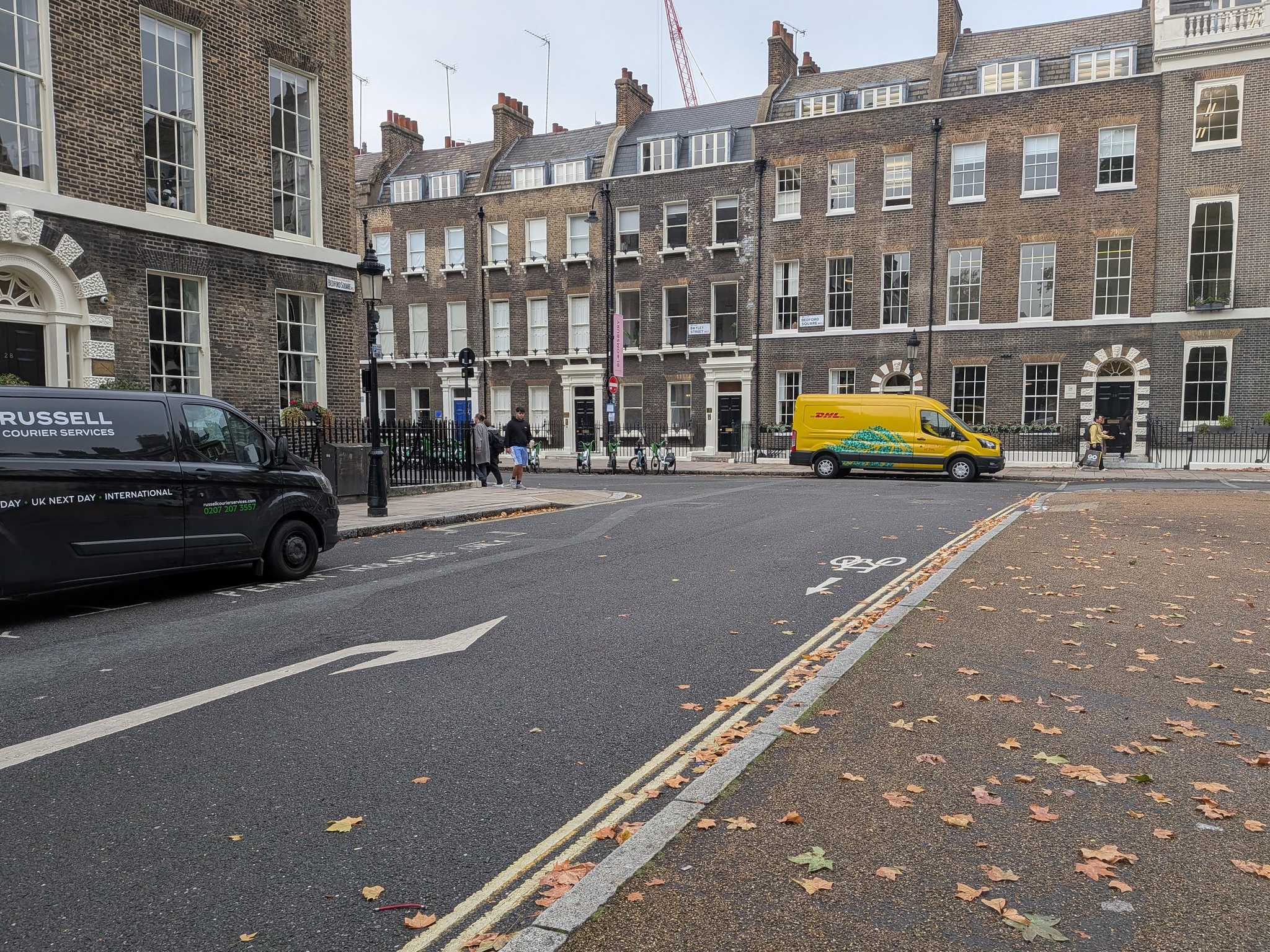
In the photo on the right, we need to establish priority e.g. with a ‘Give Way’ at Bayley Street.

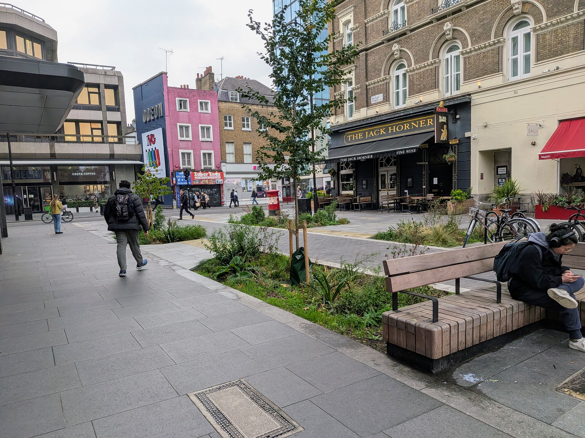
From around 2022, a large building on the corner of Bayley Street and Tottenham Court Road was demolished and a new one built. During this period the western end of Bayley Street was blocked. This has now been replaced by a ‘pocket park’ with a two-way cycle lane through the middle.
Greening pictures
Who would ever believe that Chalk Farm Road could become so green and beautiful?

