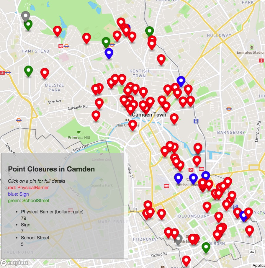
Some apps and maps we have developed for cycle campaigning
Cycle campaigners often use code to mine for the key data needed to support road changes. We have built and shared some tools and customised maps to help with that.
All reports and talks, mostly written by CC
Cycle campaigners often use code to mine for the key data needed to support road changes. We have built and shared some tools and customised maps to help with that.
The Traffic Analysis Tool conducts surveys of estimated motor vehicle journey times taking account of traffic congestion as estimated by Google Maps. The tool accepts a request for a specific route and collects Google’s predicted motor vehicle driving time repeatedly over any period of duration between 6 hours to 14 days. Full instructions for use
Coordinator’s and Rides Report 2019-2020 Presented by John Chamberlain at AGM on 18th May 2020
Presented by Meade McCloughan at AGM on 18th May 2020
The maps show (1) Covid-19 highway interventions already completed or signed-off by Camden and (2) those collected by Camden Cycling Campaign
Presented by George Coulouris at a meeting with Climate Emergency Camden representatives on 9 December 2019. The Camden Cycling Network-printable handouts The slides in Google Drive.
Closure of Frederick St greening?;tiger crossing over Calthropre st; Gough St cobbles; contraflows in Eyre St Hill and Saffron St; queries and snagging issues
Extracts and update the main results: (23% inc RCS from Aug 2016) 29% increase in Pancras Road and 11% increase in RCS (N) in ten weeks from 1st July compared with previous year.
Presented by John Chamberlain at AGM 20th May 2019