

Highgate Ward By-Election
All four candidates were invited to meet us and to provide a statement.
All four candidates were invited to meet us and to provide a statement.
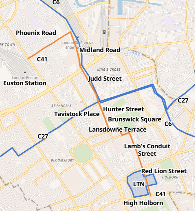
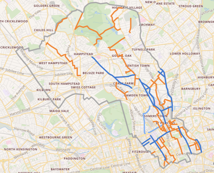
Now that TfL has given the number C41 to the cycle route from Holborn to Kings Cross with an extension to Euston, we look at the changes that can enhance a cycleway.


Talk by Akwesi Osei of We Are Possible at CCC AGM May 15th 2023; report on research at Active Travel Academy on race, ethnicity and mobility
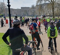
On 22nd April 2023 Camden Cycling Campaign, Westminster Cycling Campaign & XR Camden, gathered at Swiss Cottage library for this family-friendly ride.

Protected cycle lanes, LTNs, healthy school streets, safer junctions, permeability and completion of the West End Project
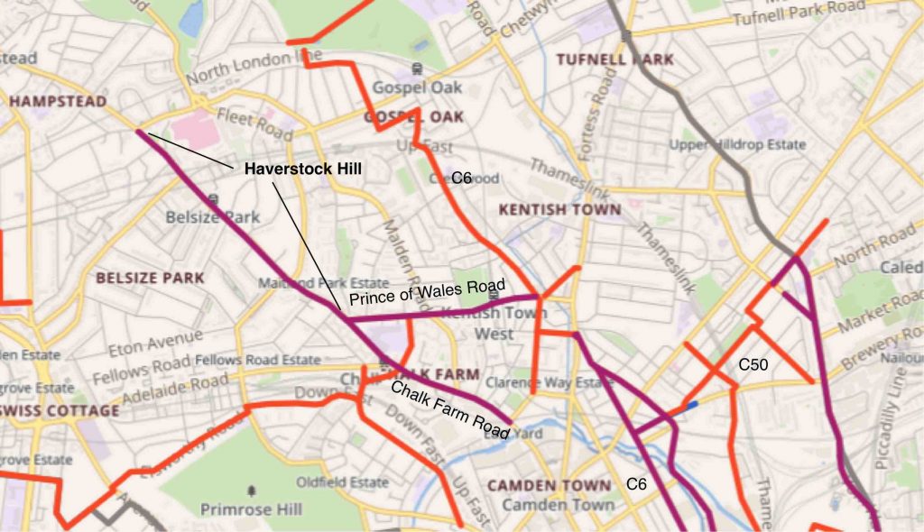
The 2km of new protected lanes on Haverstock Hill connect Belsize Park to the remainder of the Camden Cycling Network in the southeast of the borough.
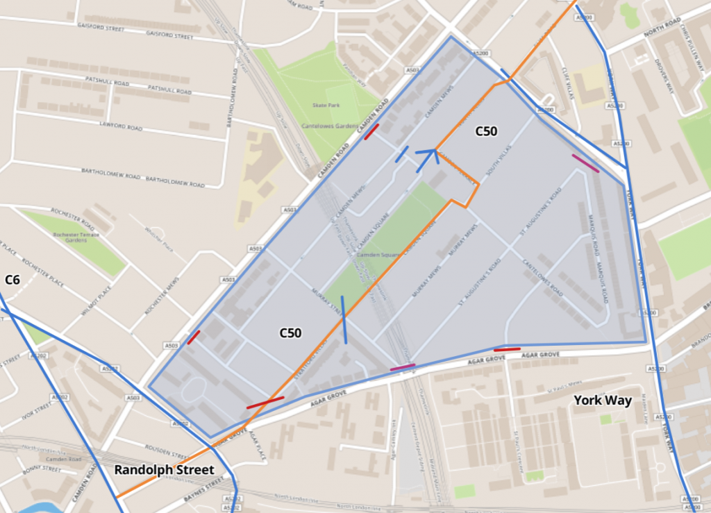
We show how over 2 kms of good quality cycle route has been created from the Camden Square low-traffic neighbourhood, two-way cycling in Randolph Street and several upgraded junctions.
Strategic Lead of Transport Planning at Camden Council spoke about Camden’s Cycling Action Plan.

Asks sent to all 4 party leaders and discussed with Georgia Gould and Adam Harrison, Labour – PLEDGED; Sian Berry and colleagues, Greens – PLEDGED; Tom Simon and colleagues, LibDems – PLEDGED.